FENSTANTON FOOTPATHS 1983
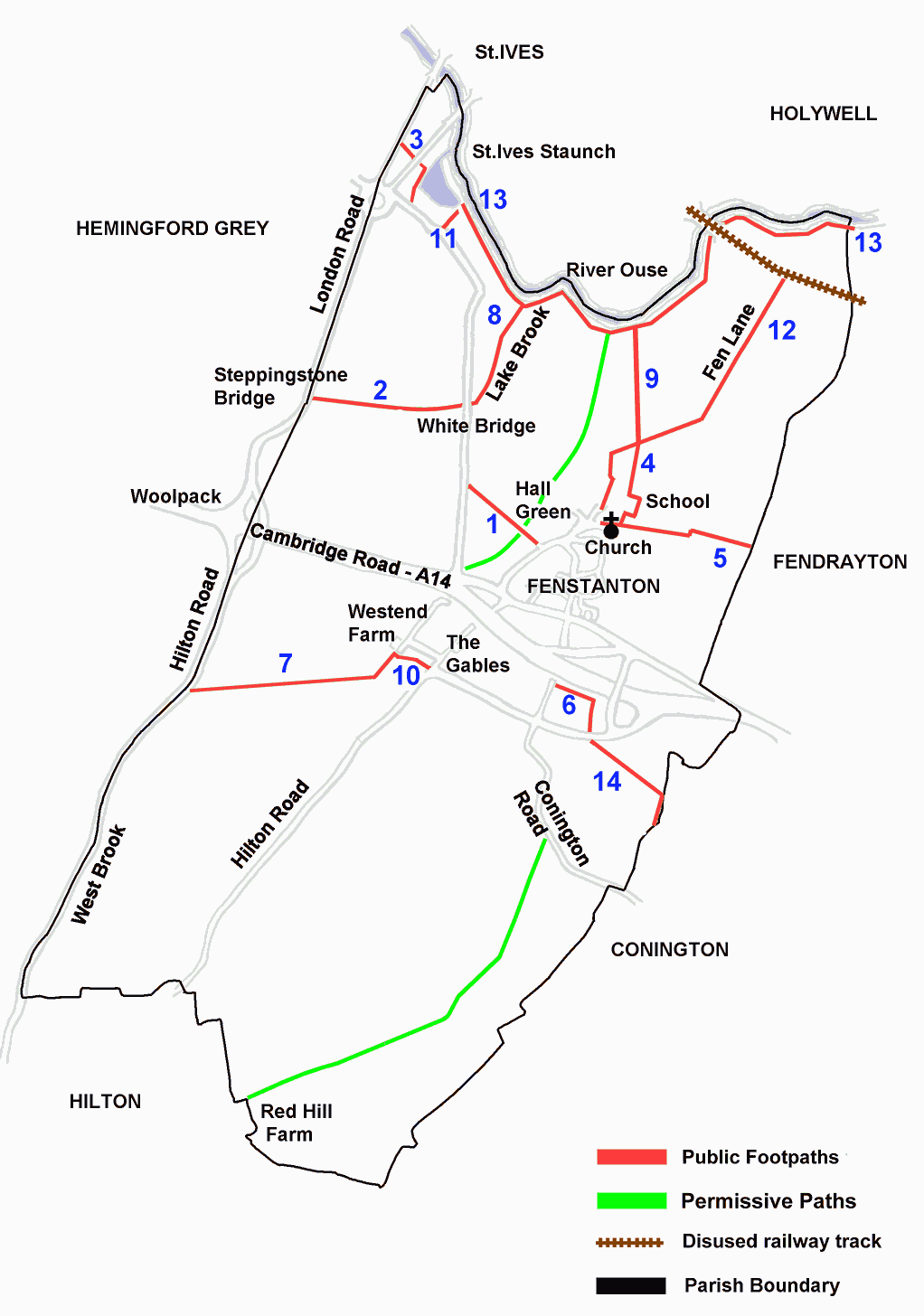
Sketch based on the Definitive Map of Footpaths prepared under the National Parks & Access to the countryside Act 1949
FOOTPATHS AROUND FENSTANTON – printable version
Public Roads
Conington Road A public road along an ancient track.
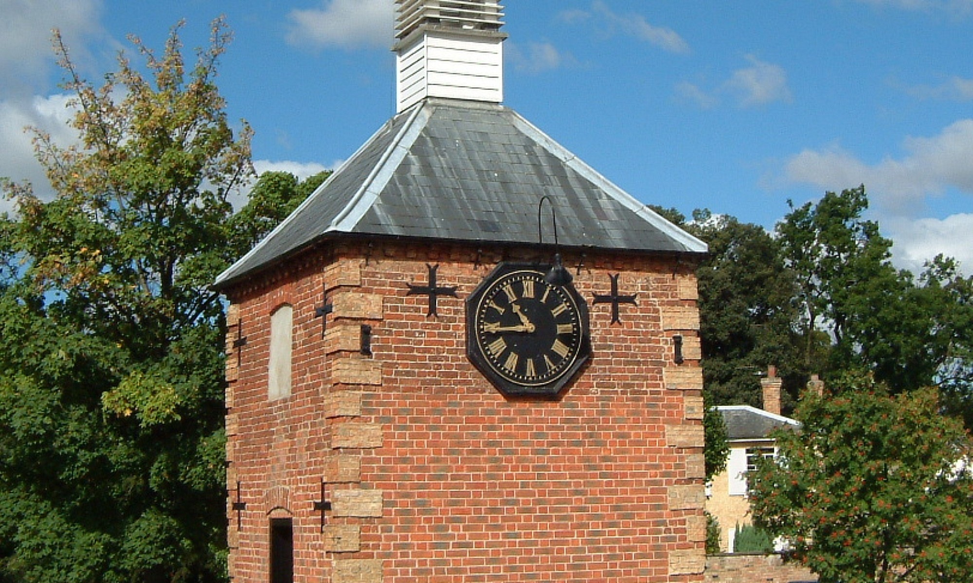
Hilton Road Part of the road from the Clock Tower was called Pig House Lane; Pig House Farm is now called The Gables. Presumably an ancient track led from there to Hilton, and this the Commission declared a public road. It is now cut by the Fenstanton bypass with a footpath subway under it.
Turnpike Roads
These are the St.Ives-Hilton (Potton) Road and the Godmanchester-Cambridge Road, which the Commission did not alter.
St.Ives Road Now called the Low Road. The Commission made it a Public Bridle Way (the public could go on horseback or on foot) and a Private Road Way (a carriage could travel over it) for the “use and convenience of the owners and occupiers” of the lands beside it.
Public Footpaths
Steppingstone Bridge Footway [1 & 2] A footpath across Hall Green and the Low Road to Hemingford Grey. From the Low Road the route has been slightly altered to run alongside Lake Brook. It has a signpost at each end.
St.Ives Footway [3] This was a short cut for pedestrians between Fenstanton and St.Ives across the fields. It was cut once by a water channel which apparently was agreed under the 1949 Act. A second channel was cut which has a footbridge over it & the path continues under the St.Ives bypass.
Footway to the Fen [4] This is a good path between the church and Fen Lane.
Footway to Fendrayton [5] This is a good path between the church and Fendrayton. The route has been altered a few feet, as the Fenstanton end gate is located in a hedge.
Footway to Conington [6] This is a path signposted at the Fenstanton end of Conington Road, but is now crossed by a road and terminates at a fence. Across the road the footpath continues to Conington and is signposted.
Footway to Hilton Turnpike [7] From West End Farm Road this is a good walk beside a gravel pit with interesting bird life, and it is signposted.
Permissive Roads (granted by landowner & tenants)
Conington Road – Hilton Wooden signpost off Conington Road. Panoramic view of countryside. Granted by owner of Conington Hall and tenant Keith Burgess.
Alongside Hall Green Brook From Low Road Toll Gate to the river. Granted by Christopher Behagg
Private Roads
Fen Road [12] Now called Fen Lane and a public footpath.
Cootes Fen Road Now called Short Drove. It leads off Fen Lane and stops just past the osier bed.
Hammonds Road West This does not now exist; it used to run from Low Road Turnpike corner to West end farm
Trustees of the Poor Estate From the south west side of Conington Road towards Hilton passing Red Hill Farm.
River Road [8] Now called White Bridge Drove leading from the Low Road White Bridge alongside Lake Brook to a meadow belonging to the Town Trust. Now a public footpath. Additions under the 1949 Act
Additions under the 1949 Act
Tow Path [13] Runs along the river bank boundary of the parish.
To St.Ives Staunch [11] Signposted, it leads to the staunch
Fen Lane-River [9] Signposted.
Hilton Rd-West End [10] Signposted at each end.